
To add hiking trails to your route planner, first choose a reliable app or software that supports offline maps and trail data. Look for features like trail overlays, GPS accuracy, and community-shared info. Import GPS files in supported formats such as GPX or KML and customize layers to suit your needs. Keep in mind safety and environmental factors as you plan, and if you continue exploring, you’ll discover ways to enhance your trail experience even more.
Key Takeaways
- Choose route planning tools with robust trail databases, offline maps, and GPS support for accurate trail integration.
- Import trail data in compatible formats like GPX or KML to add hiking trails to your route planner seamlessly.
- Verify trail details such as elevation and difficulty to ensure they match your preferences and safety requirements.
- Use trail overlays and custom map layers to differentiate routes and avoid clutter during planning.
- Save, share, and update your trail routes regularly to enhance planning and coordinate with others effectively.
Assessing Your Hiking Goals and Preferences

Before adding new hiking trails to your route planner, it’s essential to understand your hiking goals and preferences. Think about what motivates you—are you seeking challenging climbs, scenic views, or peaceful solitude? Consider your fitness level and how much time you can dedicate to each hike. Do you prefer trails with well-marked paths or more rugged, remote routes? Identifying these priorities helps you choose trails that align with your interests and capabilities. Reflect on past hikes to pinpoint what you enjoyed most and what you’d like to avoid. By clarifying your goals, you ensure your route planner supports a fulfilling and safe hiking experience tailored to what you truly want out of each adventure. Understanding top-rated trails can also help you select options that meet your preferences.
Selecting the Right Route Planning Tools and Apps
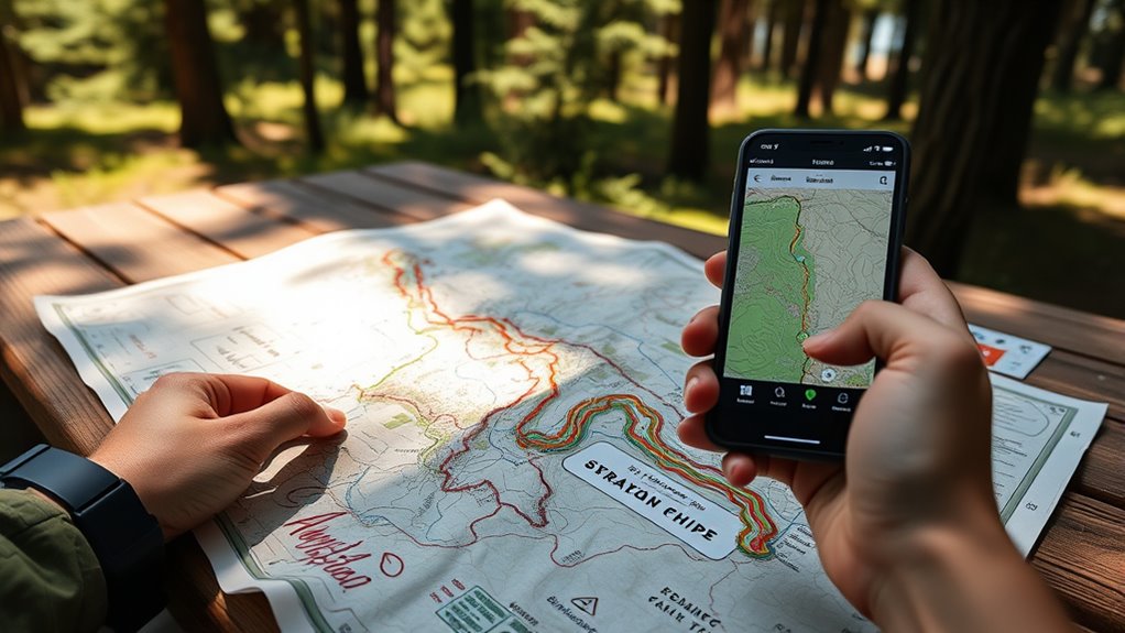
Choosing the right route planning tools and apps is essential for a successful hiking experience. The best tools help you navigate, discover trails, and stay safe. When selecting an app, consider features like offline maps, trail databases, GPS accuracy, and user reviews. Some apps focus on detailed topographic maps, while others emphasize community-shared trail info. To find the right fit, compare options based on your needs and device compatibility. Additionally, understanding trail conditions can help you plan better and avoid unexpected difficulties.
Finding Accurate and Up-to-Date Trail Information

Once you’ve selected your route planning tools, the next step is guaranteeing the trail information you rely on is accurate and current. Start by checking official park or trail websites, which often provide the latest updates on trail conditions, closures, and maintenance. User reviews on apps like AllTrails or Gaia GPS can offer recent insights from fellow hikers, but verify their dates to ensure relevance. Social media groups dedicated to local hiking spots can also be valuable for real-time updates. Always cross-reference multiple sources before finalizing your plans. Keep in mind that trail conditions can change rapidly due to weather or maintenance work, so staying informed helps you avoid surprises and ensures a safer, more enjoyable hike. Additionally, understanding trail maintenance practices can help you better interpret reports and avoid areas that may be temporarily unsafe. Being familiar with Leave No Trace principles encourages responsible camping and hiking, which benefits the environment and preserves trail conditions for future visitors. Staying aware of technology advancements in mapping can further enhance the accuracy of your trail information. Moreover, knowledge about electric bikes and their speed capabilities can help you plan for trail sharing and safety considerations if biking is permitted.
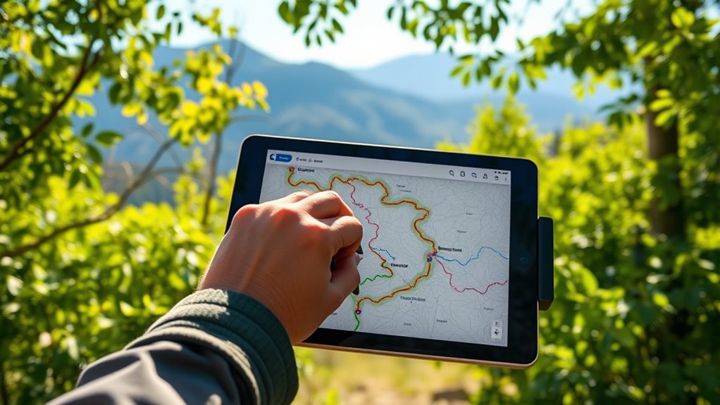
Integrating Trails Into Your Navigation System

To effectively integrate trails into your navigation system, you need to understand different trail data formats and guarantee they’re compatible with your route planner. Checking route compatibility helps prevent errors and ensures smooth navigation along your preferred trails. Additionally, optimizing the user interface makes it easier to access and follow trail information seamlessly during your hikes. Incorporating data-driven strategies can further enhance the accuracy and reliability of trail integration.
Trail Data Formats
Integrating hiking trails into your navigation system requires understanding various trail data formats, which serve as the foundation for accurate mapping and routing. Different formats encode trail information uniquely, influencing how effectively your system interprets and displays trails. Familiar formats include GPX, KML, and GeoJSON, each offering distinct advantages:
- GPX (GPS Exchange Format): Widely supported, ideal for sharing detailed trail data with waypoints, tracks, and routes.
- KML (Keyhole Markup Language): Used primarily with Google Earth, suitable for visualizing trails in 3D environments.
- GeoJSON: A lightweight, web-friendly format that allows easy integration with online mapping platforms. Understanding how different trail data formats encode information can improve your route accuracy and display options, especially considering the data standards that ensure consistency across systems. Additionally, being aware of standardized data formats can facilitate smoother data sharing between applications and devices.
Route Compatibility Checks
After importing trail data in formats like GPX, KML, or GeoJSON, the next step is to verify that these trails are compatible with your navigation system. Check if your software recognizes the data format and supports trail attributes such as elevation, waypoints, and track types. Guarantee the coordinate reference system matches your system’s requirements to prevent misalignment. Test a sample trail to see if it loads correctly and displays on your map without errors. Confirm that trail data doesn’t conflict with existing map layers or routing algorithms. Compatibility issues can cause navigation errors or missing trails. If problems arise, consider converting the data to supported formats or updating your software. Performing these checks helps ensure seamless trail integration and reliable navigation during your hikes. Additionally, understanding GMC tuning techniques can optimize your vehicle’s performance when exploring rugged terrains. Being aware of software updates can also help resolve potential compatibility issues before they affect your navigation experience. For advanced integration, consider reviewing trail metadata to ensure all relevant information is accurately represented. Proper data validation can further prevent errors and improve overall trail mapping accuracy.
User Interface Integration
Once you’ve confirmed your trail data is compatible with your navigation system, the next step is to seamlessly incorporate these trails into the user interface. This involves customizing how trails appear and ensuring easy access during your trip. To do this effectively, consider these key actions:
- Map Layer Integration: Add trail overlays as separate layers to toggle visibility without cluttering your main map.
- Visual Styling: Use distinct colors and icons to differentiate trails from regular routes, aiding quick identification.
- Search and Bookmark Features: Enable searching for specific trails and bookmarking favorites for instant access.
- Incorporate spiritual symbolism and cultural elements into your trail visualizations to enrich your experience and connect with the environment on a deeper level. Recognizing the importance of emotional readiness can also enhance your journey, allowing you to better appreciate the natural surroundings and deepen your connection. Understanding and respecting cultural intelligence can help you interpret the significance of certain symbols and practices encountered along your trail, fostering a more meaningful experience. Additionally, integrating environmental awareness into your interface can promote responsible trail use and preservation of natural sites.
Customizing Your Hiking Route for Safety and Enjoyment

To guarantee your hike is safe and enjoyable, you should assess the trail difficulty and consider current weather conditions. Picking a trail that matches your skill level helps prevent accidents, while checking the forecast keeps you prepared for changes. Adjusting your route based on these factors lets you maximize enjoyment without risking safety.
Trail Difficulty Assessment
Evaluating trail difficulty is essential to tailoring your hike for safety and enjoyment. It helps you choose routes that match your experience level and physical condition. To assess difficulty accurately, consider these factors:
- Terrain Type: Steep climbs, rocky surfaces, or muddy paths increase challenge.
- Distance & Elevation Gain: Longer routes with significant elevation changes demand more stamina.
- Trail Conditions: Narrow, exposed, or poorly maintained trails can affect safety and comfort.
- Local trail statistics can also provide valuable insights into the typical challenges faced on specific routes.
Weather Considerations
Weather conditions can considerably impact the safety and enjoyment of your hike, making it important to check the forecast before setting out. Look for updates on temperature, precipitation, wind, and storms that could affect trail conditions. Rain can make paths muddy and slippery, increasing the risk of falls, while extreme heat or cold can lead to health issues like heat exhaustion or hypothermia. Windy weather may also cause falling branches or debris. If severe weather is predicted, consider postponing your hike or choosing an alternative trail. Always pack appropriate gear, like rain jackets or sun protection, based on the forecast. Being aware of weather conditions helps you prepare properly, ensuring a safer, more enjoyable outdoor experience. Monitoring essential oil benefits can also help you manage minor ailments like headaches or congestion if needed during your hike. Additionally, understanding the value of home security systems can offer insights into protecting your home and belongings while you’re away on outdoor adventures. Furthermore, incorporating sound healing science principles such as calming frequencies can help you relax and recover after a long hike. Staying informed about weather trends also aligns with fostering digital literacy for outdoor safety, especially if you utilize smartphone apps or GPS devices to track weather updates and trail conditions during your hike.
Sharing and Saving Your Customized Trails
Once you’ve customized your hiking trails, sharing and saving them guarantees you can revisit or distribute your routes easily. Saving your trails ensures you won’t lose your hard work and allows quick access for future adventures. Sharing them lets you exchange routes with friends or fellow hikers, promoting group planning and collaboration. To maximize your trail management, consider these options: diversification in retirement portfolio, which can help protect your investments from economic downturns. Additionally, understanding contrast ratio can improve how your routes are visualized on digital maps with high image quality. Cookies are used to enhance your browsing experience and can be managed to suit your privacy preferences. Properly managing local tips can enhance your navigation and route planning, ensuring a smoother outdoor experience. 1. Save your routes in your account for quick retrieval and editing. 2. Export trail files to share via email or messaging apps. 3. Use sharing links or social media to distribute your favorite routes publicly or privately. These steps streamline your planning process, making it simple to organize, revisit, and share your hiking experiences with others.
Tips for Navigating and Exploring New Trails Safely

When exploring new trails, taking proactive safety measures can make your adventure both enjoyable and secure. Always carry a map, compass, or GPS device to avoid getting lost. Let someone know your plans and estimated return time before heading out. Dress appropriately for the weather and wear sturdy, comfortable footwear. Stay on marked paths to minimize environmental impact and reduce injury risk. Bring essentials like water, snacks, a first aid kit, and a flashlight. Pay attention to trail signs and your surroundings, and don’t rush—take your time to navigate carefully. Trust your instincts; if something feels off, turn back. Proper trail preparation includes researching the trail difficulty and current conditions to ensure a safe experience. Being aware of digital distractions and minimizing screen time can help you stay focused on your surroundings and enjoy the natural environment more fully. Additionally, understanding trail safety guidelines can greatly enhance your preparedness and confidence while hiking. Carrying a first aid kit is essential for addressing minor injuries promptly. By staying alert and prepared, you’ll enjoy your hike and return safely, ready for your next adventure.
Frequently Asked Questions
How Do I Ensure Trail Accessibility for All Skill Levels?
You want to make sure everyone can enjoy the trails, regardless of skill level. Start by researching trail difficulty ratings and descriptions to match each hiker’s experience. Use user reviews and official resources to verify accessibility features like smooth paths, signage, and rest areas. Include a variety of trail options in your plan, from easy walks to more challenging hikes, so everyone finds a suitable adventure.
Can I Add Multiple Trails to a Single Route Plan?
You can definitely add multiple trails to a single route plan. Most route planners let you customize your route by including various trail segments, so you can explore different areas or combine trails for a longer hike. Just select each trail individually and arrange them in your preferred order, ensuring the progressions are smooth. This way, you create a personalized, seamless adventure that covers all the trails you want to experience.
How Do Weather Conditions Affect Trail Planning and Safety?
Weather can be a trail’s silent gatekeeper, dictating your safety and experience. Storms, rain, or snow can make paths slippery, increase risks, and cause delays. Always check the forecast before heading out, and adapt your plans accordingly. If conditions look hazardous, consider postponing or choosing alternative routes. Staying weather-aware guarantees you enjoy your hike safely, turning nature’s unpredictable elements into an adventure rather than a danger.
Are There Recommended Gear Tips for Varied Trail Types?
When tackling varied trail types, gear is key. You should wear sturdy, comfortable footwear tailored to the terrain, whether it’s hiking boots for rocky paths or trail runners for softer ground. Pack layers to adjust to weather changes, and carry essentials like a map, compass, and plenty of water. Don’t forget a small first aid kit and sun protection. Being prepared helps you stay safe and enjoy every trail, no matter the terrain.
How Can I Find Local Trail Communities or Groups?
To find local trail communities or groups, start by exploring social media platforms like Facebook or Meetup, where many groups organize hikes and trail events. Check out local outdoor stores and visitor centers, as they often have bulletin boards or info sessions. Join online forums or apps dedicated to hiking, and ask for recommendations. Connecting with these groups enhances your experience, builds friendships, and helps you discover new trails to explore.
Conclusion
Now that you’re equipped with the tools and tips, your hiking adventures become a vibrant tapestry waiting to unfold. Think of your trail planner as a trusted compass guiding you through uncharted woods, with each trail a new melody to explore. Embrace the journey with confidence, weaving safety and joy into every step. With your customized routes in hand, every hike transforms into a personal story—an endless dance with nature’s rhythm.